The politics of making maps
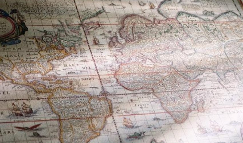
The US government chose not to change its official maps of the region, because, the US State Department press spokesperson said, “we reject the Russian attempt to annex Crimea”. National Geographic, on the other hand, shaded Crimea grey, its sign of “an area of special status”.Google’s response may have shown the situation’s complexity the best: at the end of April, the international mapmaker simply produced three different versions. To visitors accessing the site from Ukraine, Google Maps left Crimea as it looked before Russia’s invasion – as a part of Ukraine. But it changed the map for those accessing the Russian version of the site, showing Crimea as separate from Ukraine with a thick line. International visitors, on the other hand, saw a version with a dotted line, the sign of a disputed border.Now, in an apparent nod to the situation’s increasing intractability, a dotted line has appeared for the Ukrainians – but it is far fainter and less noticeable than the one on the international version.Mapmaking has always been a complex process, requiring cartographers to weigh political situations, among others, against the needs of their audience.“People generally assume that, well, science is just objective, and what we do in cartography is represent the world ‘out there’. But it’s never as clear cut,” said Christine Leuenberger, a Cornell University professor who researches politics and cartography. “Maps are always selective. You always have to omit as much as you include. So they’re always political. It’s impossible to construct an apolitical map.”Borders are not the only sensitive detail. In 2012, Iran’s government threatened to sue Google over its map’s lack of label for the Gulf, which Iranians call the Persian Gulf and Arab countries call the Arabian Gulf. Two years previous, Iran had announced that airlines using in-flight maps with the Arabian Gulf label would not be allowed into Iran’s airspace.Or take the case of the West Bank. The United Nations – which many mapmakers turn to for direction in how to delineate borders and territories – uses GPS technology to mark exactly where the separation barrier between Israel and the West Bank lies. But for some, Leuenberger said, even that isn’t accurate enough. “Palestinian stakeholders say, ‘hey – where you depicted the barrier does not portray the geopolitical reality on the ground, because the barrier is not just a wall and a fence, but part of a segregation zone’,” she said. “So you cannot map the barrier as separate from the checkpoints and no-go areas that are near the barrier. You have to map the whole thing together.”Given the difficulty, most cartographers have guidelines for determining how to deal with potential complications. US-based mapmaker Rand McNally, for example, changes national borders only when the US State Department recognises a change, although it will shade areas under dispute.But cartographers with a more international audience, like Google, have to be particularly sensitive. Representing a territory in a certain way might not just irritate customers: it might mean the map doesn’t comply with a region’s regulations and laws – making it illegal, or at least unsellable.Nokia’s mapmaking platform HERE often has to grapple with this issue, as their GPS maps are in 80% of the world’s cars that have satellite-navigation installed. “In general, we follow the UN,” said Christof Hellmis, vice president of HERE’s Map Platform office. “But if the map doesn't follow local regulations, then of course we support our customers in making the maps locally compliant.”In order for a car with HERE’s GPS technology to be shipped to China, for example, the maps need to comply with Chinese regulations. “If you ship a map to the rest of the world, Taiwan is not a part of the Republic of China,” Hellmis said. But on cars sent to China, Taiwan is mapped as part of China.Has the company ever, to the best of his knowledge, refused to make such a change, for ethical reasons or otherwise? “I’m not aware of such a case, to be honest,” Hellmis said.Even as massive mapmakers grapple with the problems of how to present the world in ways that serve both educational , commercial and political needs, they are running up against new competitors: individuals. Today anyone with web-based software such as Scribblemaps can make their own visions of the world and share them with others. Crowd-sourced cartography is getting hot, too: in late May the company Telenav, which supplies maps to carmakers, said it would switch to OpenStreetMap, a collaborative project to create a free editable world map, from its previous suppliers, which had included Nokia and TomTom. Meanwhile, users are even invited to make edits to Google Maps, although updates are reviewed and must be approved before they appear online.Maps do not just represent our perceptions of the world; they also create them. Approaches like Google Maps, in which Ukrainians see one reality, Russians another, may be commercially wise. But in failing to present one unified representation of the world, they run the risk of reinforcing their customers’ differing realities. If crowd-sourcing is the future of cartography, resulting representations of the world may be more inclusive, unified – and, of course, even more complicated.(BBC)Bakudaily.az





 Photo
Photo 

 Video
Video 